
Oslo Bay Apartments
Quick Facts
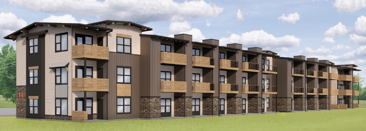
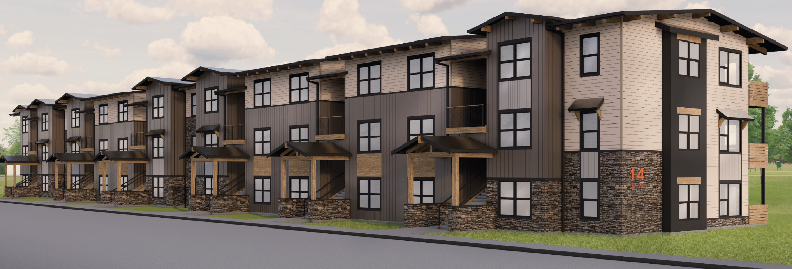
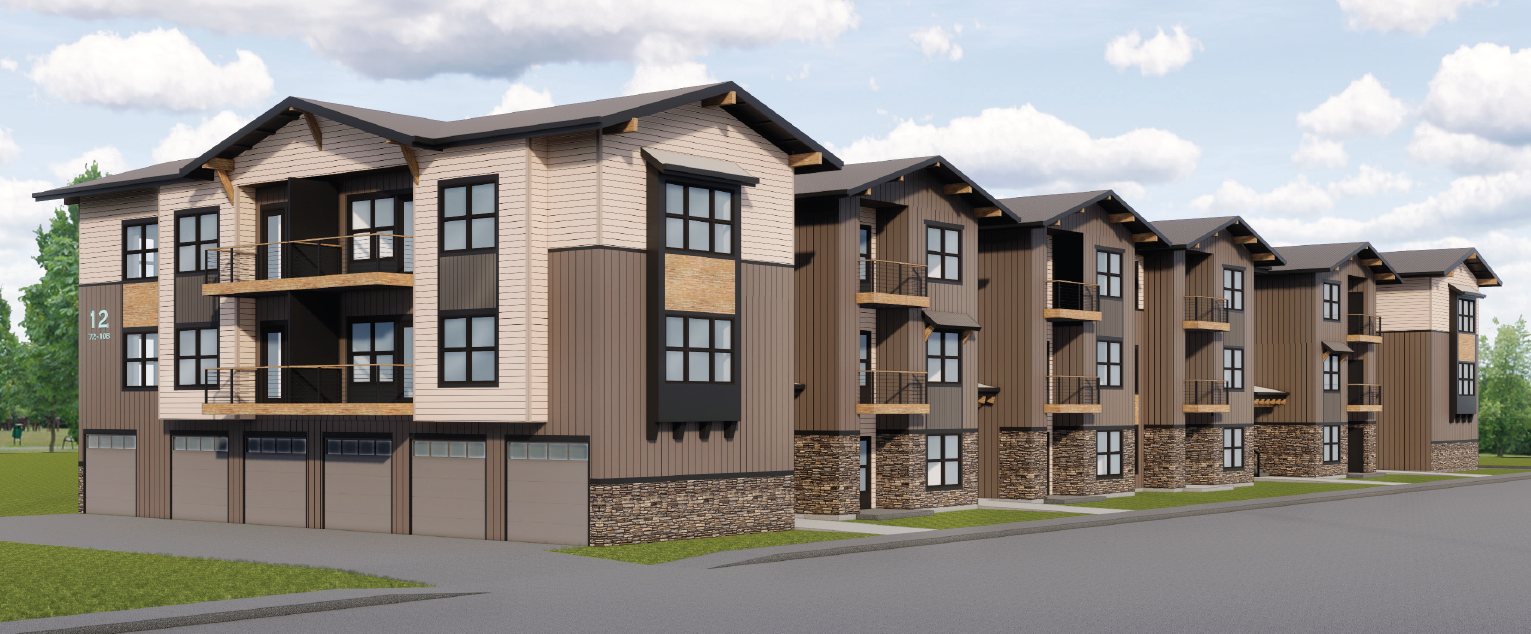
- 468 multi-family market rate residential units including 244 one-bedroom, 208 two-bedroom, and 16 three-bedroom units on three levels within the thirteen buildings.
- Located within the Residential Medium (RM) zoning district.
- Based on the zoned density allowed of 6-10 dwelling units per acre, the project could build 491 dwelling units. 468 are being constructed.
- Project meets all development standards, including a 35 foot height limit.
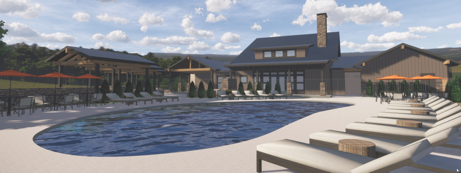
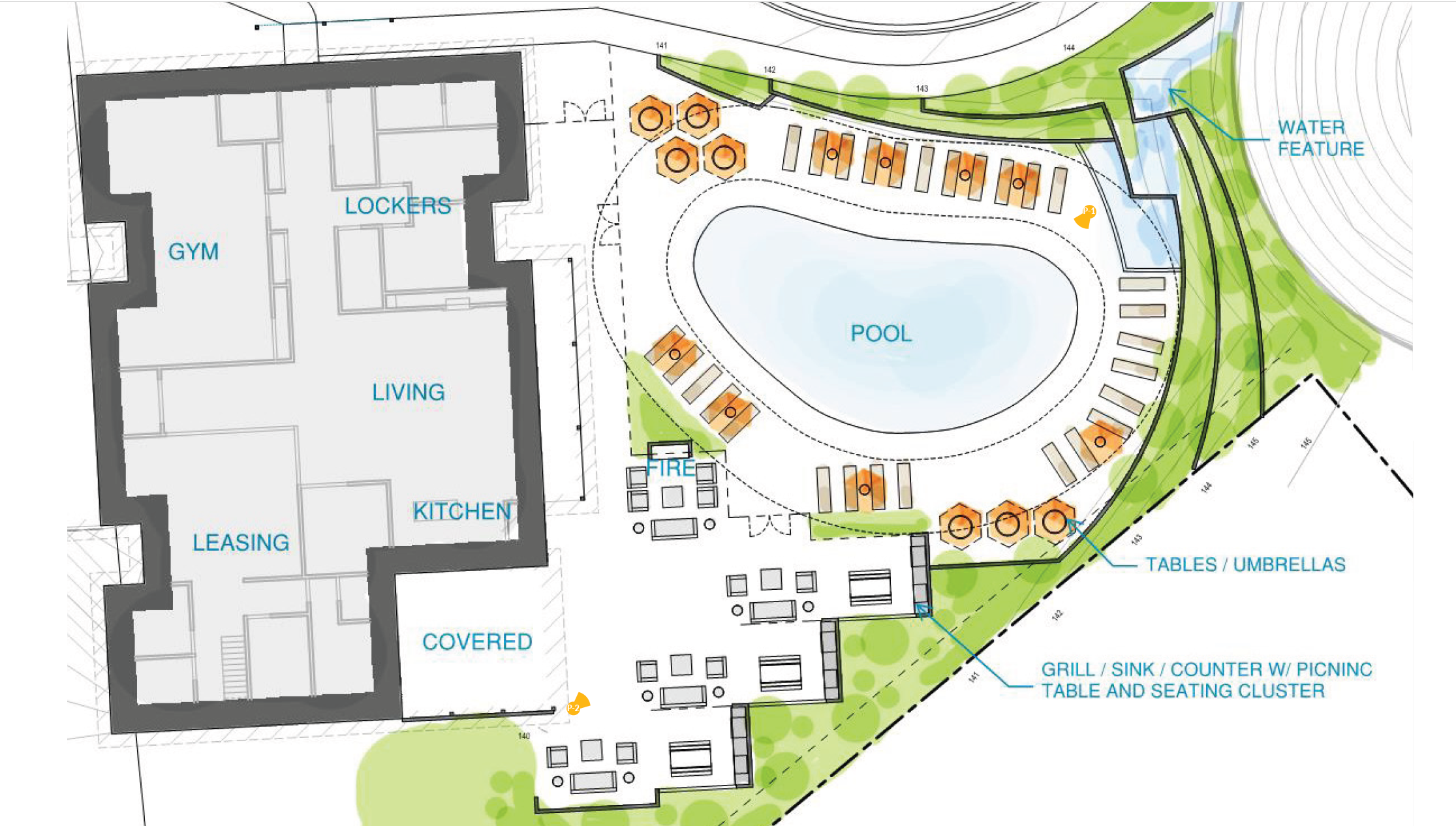
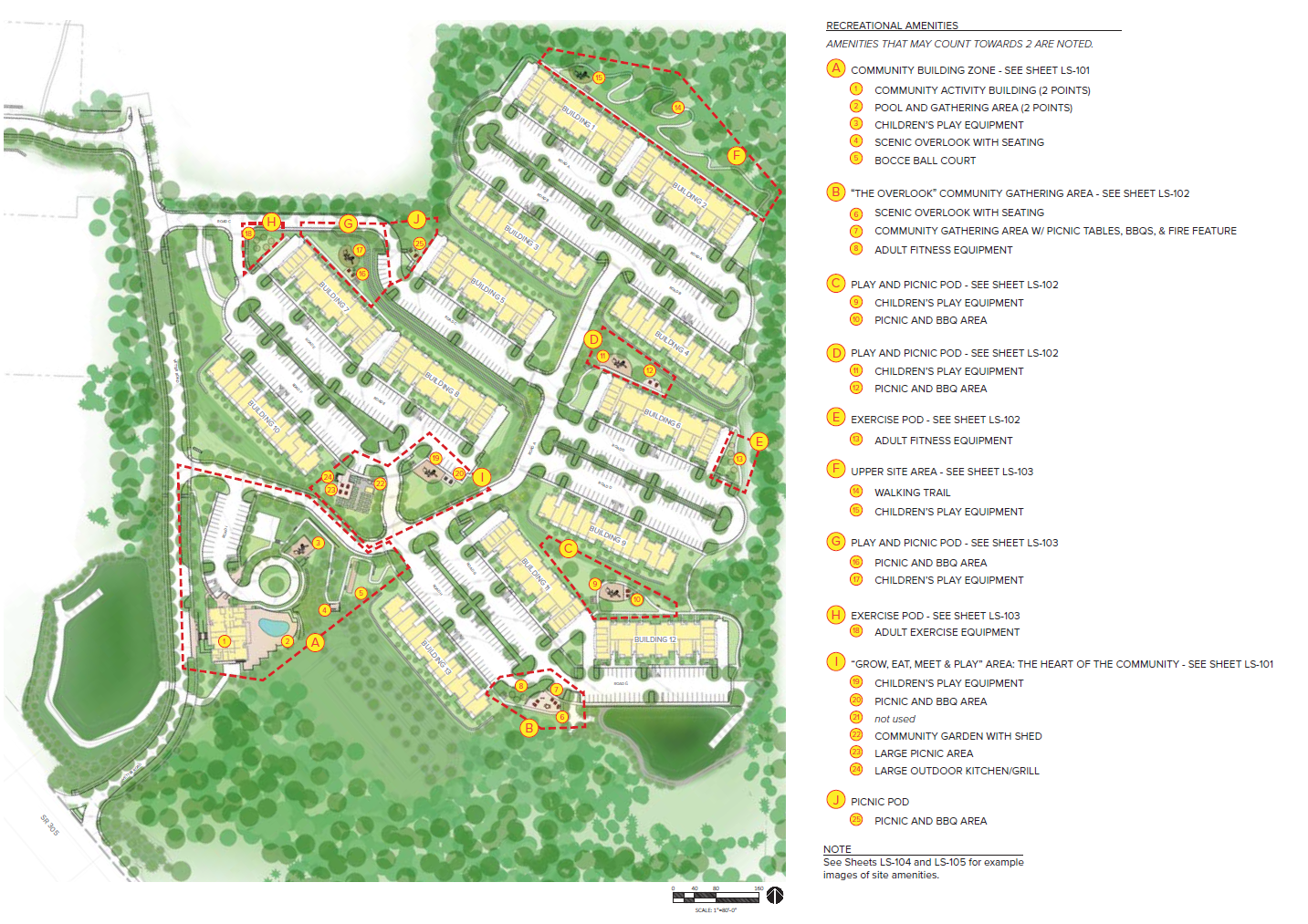
- The project requires 24 recreational amenities to be provided on site. This includes a community building with a pool, dog wash facilities, and fitness center.
- Minimum of 20% percent of the property area shall be landscaped. 21% is being provided.
- The minimum off-street parking spaces required for Multifamily attached units is 1.5 spaces per unit. Studio apartments may provide one space. Guest parking shall be provided at one space per four units. The project is providing all of the required parking.
- Tree retention is required and provided. Approximately 42% of the trees for this proposal will be retained. Much of the tree retention area includes fish and wildlife critical area habitat, wetlands, and their respective critical area buffers.
- The project will be constructed in phases.
- Approved Construction Hours per PMC 15.32 are 7am – 7pm Monday – Friday & 8am -7pm on Holidays and Weekends.
Overview
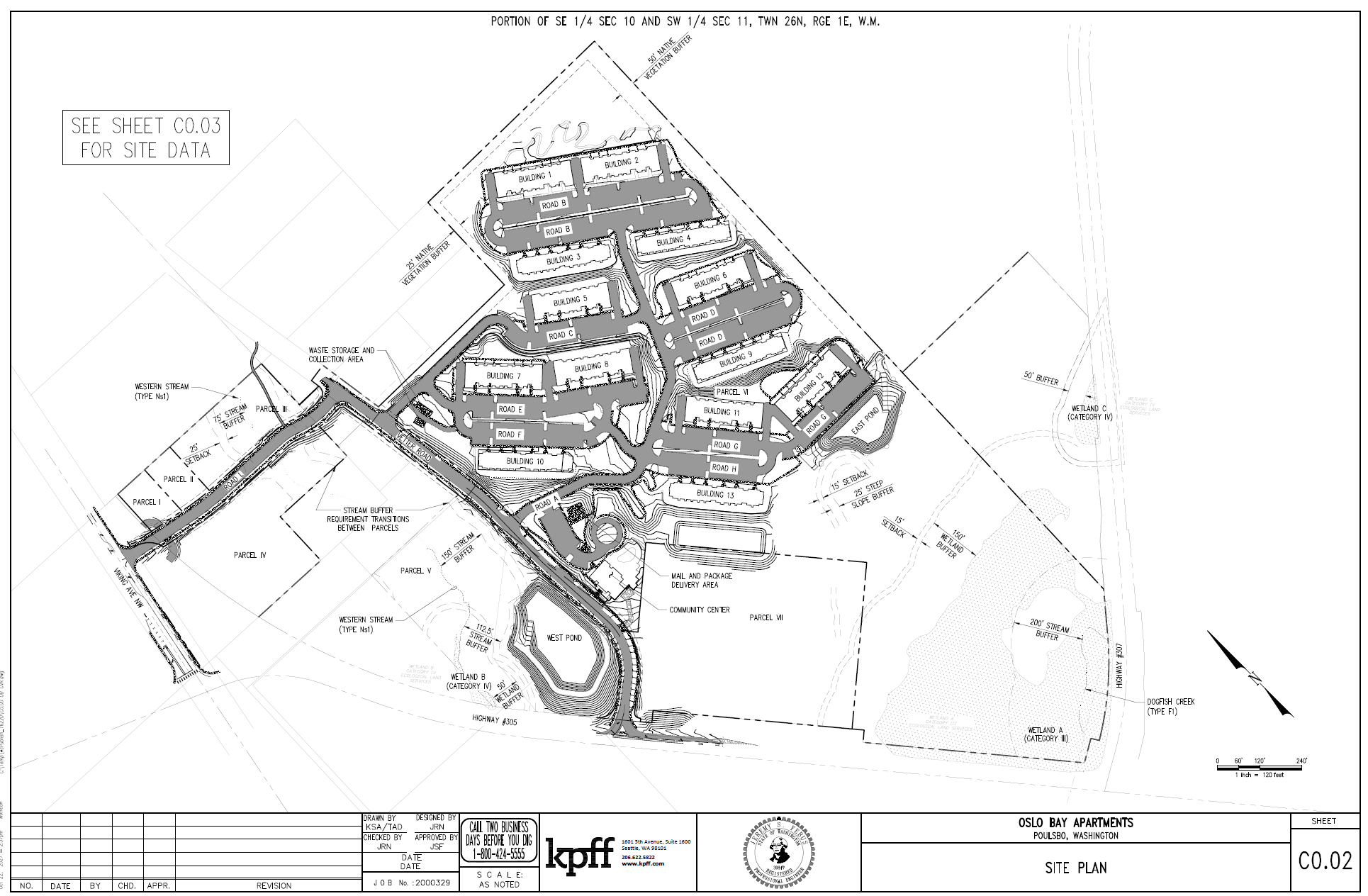
The Oslo Bay Apartments project is a residential community comprised of thirteen apartment buildings and a Community Building that encompasses 56-acres. The Oslo Bay Apartments project is located northwest of the intersection of State Route 305 (SR305) and State Route 307 (Bond Road, SR307) and will consist of 468 multi-family market rate residential units including 244 one-bedroom, 208 two-bedroom, and 16 three-bedroom units on three levels within the thirteen buildings, as shown below. A variety of common areas and resident amenities are located throughout the site and within the Community Building. The project also includes the construction of private roads, parking lots, pedestrian pathways, utilities, landscaping, and stormwater management systems. The project will also develop a public road system from SR305 to Viking Ave NW. The Vetter Road NW right-of-way (ROW) which bisects the site is proposed to be improved as a residential collector.
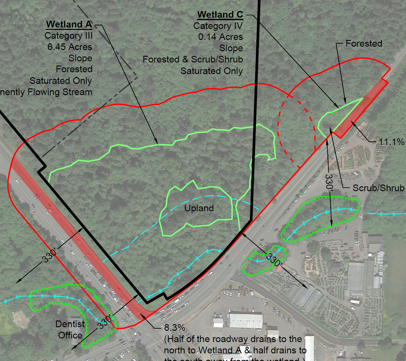
The majority of the 56-acre total project site is undeveloped forest, and includes two on-site wetlands, Dogfish Creek which runs east-west along the southern portion of the property, and an existing stream identified as the ‘western stream’ that runs on-site west of the Vetter Road ROW. Dogfish Creek is identified as a Type F1 stream adjacent to the project, and the western stream is identified as a Type Ns1 stream through the off-site portion of the project before transition to a Type F2 stream onsite, as shown below.

Traffic and Mitigation
Key analysis findings from the Traffic Impact Analysis are summarized below:
- Oslo Bay Apartments is anticipated to generate 3,619 weekday daily trips, 217 AM peak hour trips, and 278 PM peak hour trips.
- Note: at this time only the apartments are being constructed, which are anticipated to generate 3,154 new average daily trips with 187 in the AM peak hour and 239 in the PM peak hour.
- Project-generated trips will not cause any new Level of Service (LOS) deficiencies but will add peak hour delay to six intersections with existing LOS deficiencies and two LOS -exempt intersections which operate at LOS F.
- The proposed mitigation will reduce peak hour delay to better than pre-project conditions at all LOS deficient intersections.
- The proposed mitigation will reduce peak hour queuing on Viking Ave north of SR 305, preventing 95th percentile queues from impacting the Road L/Sonic/Arco intersection.
- The proposed mitigation will reduce stops along SR 305 during peak hours, reducing the likelihood of rear-end collisions and mitigates project safety impacts.
- The project proposes curb, gutter, and sidewalk along Vetter Rd, Road L, and Viking Ave from Road L to the southwest corner of the North Viking Transit Center. The project also proposes a gravel trail connection from Road L to the existing asphalt trail on the west side of Vetter Rd. Nonmotorized connections are also proposed from Road L to SR 305 and on Viking Ave south of SR 305.
- The proposed mitigation will reduce emergency vehicle response time to better than pre-project conditions.
- The construction traffic generated by the site occurs outside the AM and PM peak hours of the adjacent street system. No construction-related LOS impacts are anticipated to occur. Queuing impacts at Viking Ave/SR305 can be mitigated by scheduling truck arrivals and departures from the site outside of the AM and PM peak hours.
The summary of traffic mitigation is found in table 27 on pages 39-41 of the Traffic Impact Analysis. The eight SR305 intersections in Poulsbo will receive improvements, as outline below:
| Intersection | SR 305 Corridor Signal Improvements Mitigation |
| SR305 & SR3 SB Ramp |
|
| SR 305 & SR 3 NB Ramp |
|
| SR 305 & Viking Avenue |
|
| SR 305 and SR 307 (Bond Road) |
|
| SR 305 and Forest Rock Lane |
|
| SR 305 and Liberty Road |
|
| SR 305 and Lincoln Road |
|
| SR 305 and Hostmark Street |
|
Site History and Application Review
The Rose Master Plan was approved by the Poulsbo City Council on June 28, 2011, which coordinated the development of approximately 55 acres located northwest of the intersection of State Route 305 and State Route 307 (Bond Road). The Rose Master Plan encompassed three major elements: a 540‐dwelling unit multi‐family project, a 160‐room senior care center, and a 12,975‐square foot neighborhood mixed‐use commercial center. The Master Plan SEPA determination was a MDNS and noted phased review would be required. A Development Agreement was executed in 2013.
Following the Master Plan approval, the project proponent, Edward Rose & Sons (Edward Rose), worked over several years on detailed environmental, traffic, planning and market analysis related to its Master Plan development. This analysis resulted in some potential revisions to the Master Plan to reduce environmental impacts, improve traffic operations, remove the neighborhood commercial component, that they concluded could result in a more successful master planned community. While in the process of pursuing a Master Plan Amendment to address these revisions, it became evident that any future changes to the site plan could trigger additional Master Plan Amendments. To streamline the approval process, Edward Rose determined that the most clear and predictable permit path forward would be to release the Master Plan, extinguish the Development Agreement, remove the Master Plan Overlay from the City of Poulsbo Zoning Map, and propose a new project under current Poulsbo Municipal Code and development standards. The Master Plan Release and Development Agreement Extinguishment (Planning File P-08-06-19-01) was approved by City Council on November 20, 2019 (Ordinance 2019-20) and became effective on December 5, 2019.
The review authority for the Site Plan Review is the Planning and Economic Development Director. The application review process included:
- December 5, 2019 – Application Submitted (Site Plan Review Application Number P-12-05-19-01)
- January 27, 2021 – Application Deemed Technically Complete
- February 9, 2021 – Notice of Application Issued
- April 18, 2022 – SEPA Mitigated Determination of Nonsignificance (MDNS) Issued
- May 29, 2022 – SEPA Appeal by Applicant Received
- August 12, 2022. – Staff Report Issued
- August 19, 2022 – Notice of Decision Issued
- September 1, 2022 – Applicant Appeal of Type II Decision Received
- June 23, 2023 – Settlement Agreement Signed
- June 23, 2023 – Revised MDNS Issued
- July 5, 2023 – Revised Staff Report Issued
- July 11, 2023 – Revised Notice of Decision Issued
- September 13, 2023 – Tree Cutting and Clearing Application Received (Permit P-09-13-23-01)
- May 30, 2024 – Tree Cutting and Clearing Application Issued
Project Documents
Revised SEPA Determination and Staff Report
June 23, 2023
- Revised SEPA Determination – MDNS
- Exhibit A: Revised List of SEPA Mitigations
- Exhibit B: Revised SEPA and Environmental Analysis Memo
- Exhibit C: SEPA Environmental Checklist
July 5, 2023
July 11, 2023
Staff Report
Application (Exhibit A)
- Application Forms
- Narrative (October 2021)
- Legal Descriptions and Vicinity Map
Plan Set (Exhibit B)
- Site Plan Drawing (C0.02 and C0.03) by kpff dated 09/13/2021
- Horizontal Control and Channelization Plan (C1.00-C1.21) by kpff dated 09/13/2021
- Phase 1-3 Construction Stormwater Basin Plan (C2.00-2.02) by kpff dated 09/13/2021
- TESC Plans and Construction Sequence (Sheet C2.03-C2.21) by kpff dated 2/22/2021
- Drainage Report Full Stormwater Site Plan Report by kpff dated 9/2021
- Grading Plan Overview (C3.00-C3.16) by kpff dated 09/13/2021
- Road and Storm Drainage Plan Overview (C4.00-C4.59) by kpff dated 09/13/2021
- Sewer and Water Plan (C5.00-C5.32) by kpff dated 09/13/2021
- Site Survey and Off-Site Survey by Team 4 Engineering dated 9/30/21
Landscaping (Exhibit C)
- Landscape Plan by Osborn Consulting dated 11/1/19 (Revised Sheet L-002 on 10/26/21)
- Site Amenity Sequencing by Osborn Consulting received 10/26/21
- Tree Inventory Report by American Forest Management dated 3/18/19
- Tree Retention Narrative received 9/14/21
- Tree Retention Plans by Osborn Consulting (TP-001 to TP-104) dated 9/13/21
- Wall Exhibit by kpff dated 9/3/21
- Parking Lot Landscaping by Osborn Consulting, Inc. dated 9/3/ 2021
Design (Exhibit D)
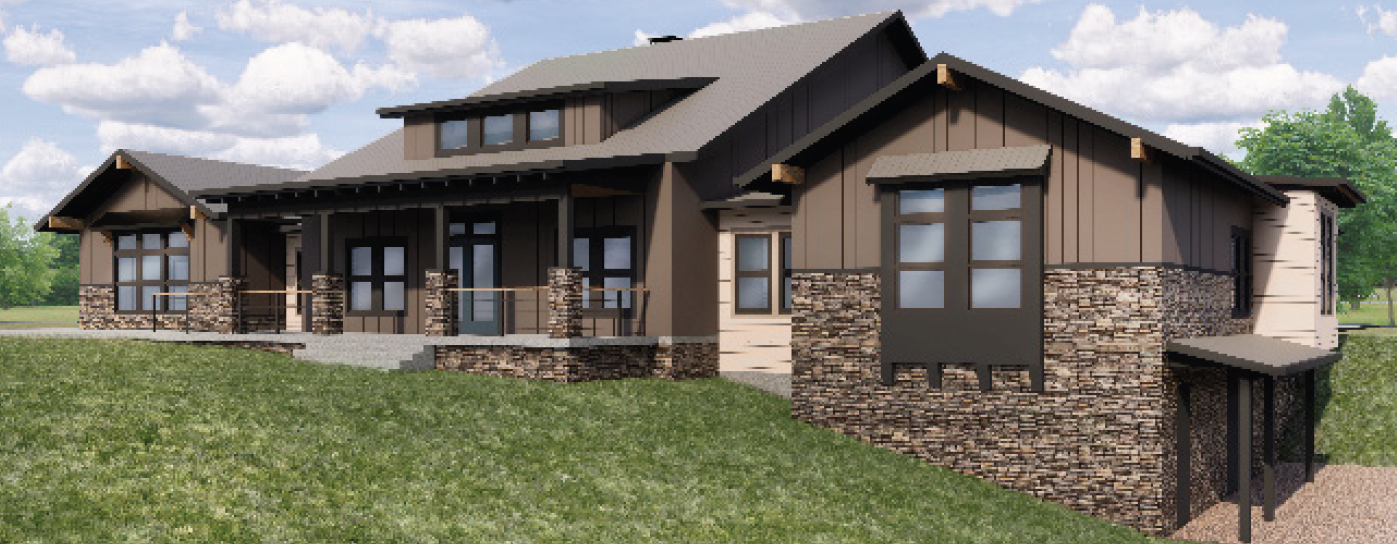
- Architectural Site Plans and Design Elements by RiceFergusMiller dated 11/1/19 (Revised 8/21)
- Site Lighting by Clarus Lighting & Controls (L200 to L210) dated 4/9/20
- Lighting Cut Sheets by Cooper Lighting Solutions dated 3/30/20
Boundary Line Adjustment (Exhibit E)
- Boundary Line Adjustment Application
- Boundary Line Adjustment Drawings by Team 4 Engineering
- Morrison Boundary Line Adjustment Drawings by Team 4 Engineering
- Morrison BLA Lot Closures by Team 4 Engineering
Notice of Application (Exhibit F)
Critical Areas (Exhibit H)
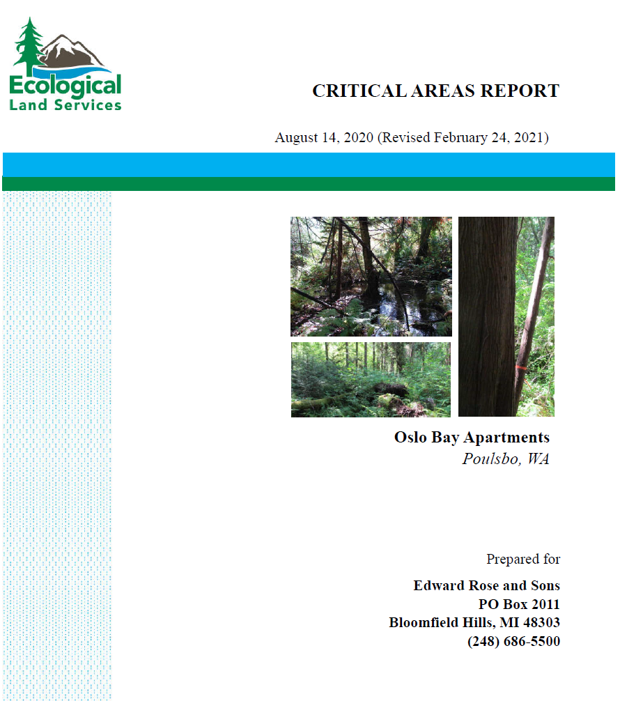
- Critical Areas Report by Ecological Land Services revised 2/24/21
- Peer Review of Wetland Delineation and Habitat Management Plan by Grette Associates dated 1/31/20
- Peer Review of Wetland Delineation and Habitat Management Plan by Grette Associates dated 7/1/20
- Peer Review of Critical Areas Report by Grette Associates dated 9/3/20
- Peer Review of Critical Areas Report by Grette Associates dated 1/20/21
- Peer Review of Critical Areas Report by Grette Associates dated 4/16/21
- Non-Wetland Determination by Ecological Land Services dated 7/16/20 (Revised 11/4/20)
- Habitat Management Plan by Ecological Land Services dated 3/7/17 (Revised 7/19/21)
- Stormwater Discharge to Wetland A by kpff dated 1/22/21
- Wetland Delineation Report by Ecological Land Services dated 7/19/16 (Revised 8/21/19)
- Stream Review for Maddox Parcel Historical Letter by BGE Environmental, LLC. dated 4/8/11
- Stream Review for Maddox Parcel Historical Letter Response by BGE Environmental, LLC. dated 5/13/11
- Regulatory Response to Rose Master Plan by BGE Environmental, LLC. dated 6/6/11
- WDFW Stream Typing for unnamed stream by WDFW dated 6/5/20
- Vetter Mapped Stream Timeline by Ecological Land Services dated 6/2/20
- Wetland Hydroperiod Analysis by Clear Creek Solutions, In. dated 2/25/21
- Critical Aquifer Recharge Area Report by Richard Martin Groundwater LLC dated 8/8/21
- Stormwater Guidelines Assessment-Revised by Ecological Land Services dated 9/24/20
- Geotechnical Engineering Report by EnviroSound Consulting Inc. dated 11/23/20
- Peer Review of Geotechnical Engineering Report by Aspect Consulting dated 1/12/21
- Peer Review of Geotechnical Engineering Report by Aspect Consulting dated 4/16/21
- Peer Review of Geotechnical Engineering Report by Aspect Consulting dated 10/11/21
- Peer Review of Geotechnical Engineering Report by Aspect Consulting dated 11/8/21
- Limited Geotechnical Engineering Report by EnviroSound Consulting Inc. dated 6/21/17
- Geotechnical Recommendations & Responses by Cobalt Geosciences dated 3/4/21
- Geotechnical Evaluation-SR 305 Stormwater Feasibility by Cobalt Geosciences dated 5/17/21
- Geotechnical Comment Letter by Cobalt Geosciences dated 6/16/21
- Geotechnical Comment Letter by Cobalt Geosciences updated 12/1/21
- Phase I Environmental Site Assessment by EnviroSound Consulting dated 11/30/10
- Phase I Environmental Site Assessment: Recycling Center Parcel by EnviroSound Consulting dated 6/23/17
SEPA (Exhibit G)
Cultural Resources (Exhibit I)
- Cultural Resources Report for the Rose Master Plan Project by Cultural Resource Consultants, Inc., dated 10/4/11
- Cultural Resources Inadvertent Discovery Protocol by Cultural Resource Consultants, Inc., dated 2/13/18
- Addendum to Cultural Resources Assessment by Cultural Resource Consultants dated 8/30/19
- Addendum to Cultural Resources Assessment by Cultural Resource Consultants, Inc., dated 7/16/21
Transportation (Exhibit J)
- Oslo Bay Apartments Traffic Impact Analysis (TIA) by Transportation Solutions Inc. dated 12/21
- Improvements to WSDOT R.O.W. Preliminary Plans by SCJ Alliance dated 8/31/21
- Transportation Concurrency Application
- Vetter ROW Vacation & PSE Easement
- Oslo Bay Apartments Frontage Improvements by Parametrix dated 4/3/22
- Proposed easement dedication for water stub
Public Services (Exhibit L)
Utilities (Exhibit K)
Public Comments (Exhibit M)
If you would like to see individual public comments, you can submit a Public Records Request here.